
Today Wahoo has announced their latest bike computer, the new Wahoo ELEMNT ROAM. Unofficially it’s the ROAM V2 or ROAM 2022 or ROAM 2nd Edition or whatever you want to call it – but no matter the name, it’s Wahoo’s flagship bike computer. This new version includes a more colorful display, upgraded multiband GNSS chipset for better GPS accuracy, as well as USB-C support.
Beyond the hardware, it also includes promises of new software features down the road, including (finally) a competitor to Garmin’s ClimbPro, which will show the distance and details of climbs as you ride them. While that feature isn’t here today, there are some additional new features that have launched over the past 24 hours to other Wahoo bike computers that are also on the ROAM V2, including Supersapiens support and new structured workout sync from Wahoo SYSTM.
We’ll dive into everything in just a moment. First, note that Wahoo sent over a media loaner Wahoo ROAM V2 to try out, and I’ve been putting it through its paces to see how the new features handle, as well as how existing features continue to function. Once it’s done, I’ll get it packaged back up and sent back to Wahoo. If you found this review useful, you can use the links at the bottom, or consider becoming a DCR Supporter which makes the site ad-free, while also getting access to a regular behind-the-scenes video series on all the reviews. And of course, being a DCR supporter makes you awesome.
What’s New:

As with most Wahoo products, most new software features are coming to other existing Wahoo products (but, not all). So really, anytime Wahoo announces a new product it’s basically two pieces: What’s new in the hardware, and what’s new in the software. However, this time is a bit trickier, because the marquee new software features of this newly announced product…umm…aren’t here yet. I can’t test them (yet).
In any, let’s start with the hardware first. The new Wahoo ROAM V2 hardware changes the following;
– Added Multiband/Dual Frequency GPS (from Sony)
– Added 64-color display (same as BOLT V2, was previous 16 colors)
– Increased to 32GB of storage (was previously 4GB)
– Changed buttons to be raised instead of divots
– Changed to USB-C charging port
– Maintained same 17-hour battery life
– Price rises slightly from $ 379 to $ 399
Then there are software features, these are new features that are basically going live today/yesterday in conjunction with the ROAM V2. I’ve listed which existing units are getting these features:
– Added Wahoo SYSTM Outdoor Workout Sync (akin to what already exists for TrainerRoad/Today’s Plan)
– Added Wahoo ROAM Backup/Restore via Wahoo cloud
– Added Supersapiens sensor integrations
And then, there are the two features that aren’t live today, nor have I tested them. Wahoo says these are ideally weeks away, but to be honest – Wahoo has a pretty rough track record the last few years when it comes to predicting software feature timelines for outstanding features at launch – usually many months behind estimates. Nonetheless, these planned features are:
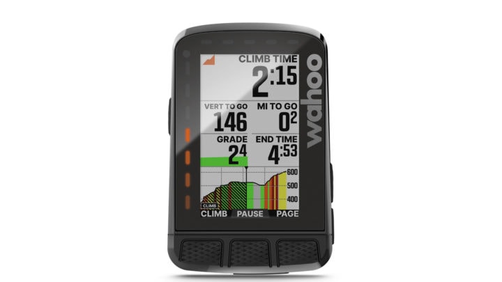
– Adding Summit Segments: This is essentially akin to what Garmin has with ClimbPro where it shows you the upcoming climb, distance to the top, and more. These are for pre-planned routes only, but it does automatically calculate the climbs that meet the given threshold on the route. That threshold is that a climb must be 500m long as well as 3% in average gradient. This feature is building atop what Wahoo launched earlier this past summer to see upcoming gradient detail. Note that both the existing Wahoo ROAM V1 and BOLT V2 units will get this (since they both have color screens).
– Adding Public Route Sharing: This feature makes it possible to quickly share routes with other Wahoo users, such as at a coffee shop prior to a group ride. This uses a blend of the Wahoo app with the ROAM to geolocate people within your vicinity, and then make it possible to quickly send a route to them.
Again, I don’t have anything more than a singe screenshot of the Summit Segment, and nothing at all for the sharing feature. As such I can’t reasonably judge on how good these implementations are in real-life. On paper, Wahoo’s implementation roughly sounds like Garmin’s longstanding ClimbPro, but falls short of Hammerhead’s more advanced CLIMBER, which doesn’t require a route be loaded. On the flip side, Hammerhead’s upcoming CLIMBER gradient is notoriously incorrect/wrong most of the time, whereas Garmin’s upcoming ClimbPro tends to be correct. I have no idea where Wahoo will land on that spectrum (good, bad, or otherwise).
In any case, into the box we go.
Setup & Basics:
First up, is the general interface for the Wahoo ROAM, which includes three buttons on top, two on the right side, and one on the left side. The upper left button is your power button, and also acts as your menu and ‘back’ button. Whereas the right side buttons are primarily used for up/down navigation, as well as zooming screens. And lastly, the topside buttons are used for changing data pages and selecting menu options.
![clip_image001[9]](http://media.dcrainmaker.com/images/2022/10/clip_image0019_thumb.jpg "clip_image001[9]")
The ‘biggest’ change to these top-side buttons is that they are now ‘outies’ versus ‘innies’, meaning that on the previous ROAM V1 they were divots (like a bowl), and harder to use with gloves. Now they pop-out instead, like all other buttons ever made on planet earth. This is the same as the Wahoo BOLT V2.
While we’re at the bottom, we’ve got the new USB-C port:
![clip_image001[11]](http://media.dcrainmaker.com/images/2022/10/clip_image00111_thumb.jpg "clip_image001[11]")
Next, along the left and top sides of the unit are LED strips. These strips illuminate for various things, such as navigation, Strava Live Segments, and zones. You can see an example of this here during a Strava Live Segment:

However, you can customize these in the app to show your speed, power, or heart rate zones, which are also customizable in the Wahoo ELEMNT app.

![clip_image001[6]](http://media.dcrainmaker.com/images/2022/10/clip_image0016_thumb-1.png "clip_image001[6]")
![clip_image001[8]](http://media.dcrainmaker.com/images/2022/10/clip_image0018_thumb-1.png "clip_image001[8]")
Speaking of which, most settings related things are configured via the Wahoo ELEMNT companion app. For example, this is where you configure data pages and data fields. Here you can create data pages with upwards of 11 data fields on them. What’s unique about the Wahoo implementation of data pages is that you ‘order’ your data fields from most to least important, such that later you can use the buttons on the ROAM to reduce the number of fields on the page mid-ride to just the most important ones.
![clip_image001[10]](http://media.dcrainmaker.com/images/2022/10/clip_image00110_thumb-1.png "clip_image001[10]")
![clip_image001[12]](http://media.dcrainmaker.com/images/2022/10/clip_image00112_thumb-1.png "clip_image001[12]")
![clip_image001[18]](http://media.dcrainmaker.com/images/2022/10/clip_image00118_thumb.png "clip_image001[18]")
![clip_image001[16]](http://media.dcrainmaker.com/images/2022/10/clip_image00116_thumb.png "clip_image001[16]")
There’s gazillions of data fields to choose from, so listing them all here would be mostly silly (though, a fun typing exercise). I haven’t heard any recent complaints about missing Wahoo data fields (that people want). So I think they’ve got about everything covered. However, there is no concept of ride profiles (for example, a different profile for road vs MTB, etc…), like most other bike computers. I’d have liked to have seen Wahoo go towards multiple ride profiles given it is something many have requested.
There’s a handful of other settings you can configure from the app, such as backlight timeout, auto pause, and more. You can see most of these from these screenshots below. For better or worse, this has long been Wahoo’s philosophy in terms of their bike computers: Make it easy and simple. On one hand, they definitely accomplish that. There’s very little to think about or configure, while still offering some customization. You’re not going to get lost in the menus of a Wahoo device or Wahoo app – it’s physically impossible, they just aren’t that deep. Whereas inversely, you’re also not going to find the level of customization or features here either that you would on other like-priced devices.
![clip_image001[20]](http://media.dcrainmaker.com/images/2022/10/clip_image00120_thumb.png "clip_image001[20]")
![clip_image001[22]](http://media.dcrainmaker.com/images/2022/10/clip_image00122_thumb.png "clip_image001[22]")
![clip_image001[24]](http://media.dcrainmaker.com/images/2022/10/clip_image00124_thumb.png "clip_image001[24]")
![clip_image001[26]](http://media.dcrainmaker.com/images/2022/10/clip_image00126_thumb.png "clip_image001[26]")
Before we pair up our sensors and get riding with it, there’s a new feature which allows you to restore from one of your backup profiles. This isn’t much different than how you can restore from a cloud backup of your phone, except, it’s your bike computer. There is no way to manually create a backup, instead, Wahoo will automatically create a backup whenever you start a workout or unpair your device. In the menus you can tap to restore it:
![clip_image001[30]](http://media.dcrainmaker.com/images/2022/10/clip_image00130_thumb.png "clip_image001[30]")
![clip_image001[28]](http://media.dcrainmaker.com/images/2022/10/clip_image00128_thumb.png "clip_image001[28]")
![clip_image001[32]](http://media.dcrainmaker.com/images/2022/10/clip_image00132_thumb.png "clip_image001[32]")
While I always appreciate new features, I’m honestly a bit perplexed by this one. I’ve never once heard a single request for this from anyone. And I feel like it’s a pretty limited use case, especially in Wahoo’s case where they don’t really have a lot of customization (compared to their competitors) of their bike computers. So while I don’t want to look a gift horse in the mouth, I’d have preferred this dev work be spent on something else.
Finally, lets pair up some sensors. You can do this via the unit or via the mobile app. If doing it from the ROAM itself, you can choose ‘Add Sensor’ in the menus, which then starts a search for nearby sensors. This will enumerate both ANT+ & Bluetooth Smart sensors, including both standard profile ones as well as customized ones.
Here’s a list of all the sensor types the Wahoo ROAM V2 supports:
– Heart Rate Sensors (ANT+ & Bluetooth Smart)
– Power Meters (ANT+ & Bluetooth Smart)
– Speed Sensors (ANT+ & Bluetooth Smart)
– Cadence Sensors (ANT+ & Bluetooth Smart)
– Speed/Cadence Combo Sensors (ANT+ & Bluetooth Smart)
– Muscle Oxygen sensors (ANT+)
– Cycling Radar Sensors (ANT+)
– Gear Shifting sensors like SRAM eTAP or Campagnolo EPS (ANT+)
– Shimano Di2 electronic shifting (proprietary ANT)
– SRAM TyreWiz Sensors (ANT)
– Supersapiens Sensors (Bluetooth Smart)
I thought it was kinda notable that the ROAM actually not only knew the name of my Garmin Rally pedals on this bike, but even more notably drew the correct icon for it (versus say, the Speedplay pedal icon). It also gave me Rally low battery warnings, which I regretfully ignored only to have them die two rides later.


You can give custom names to sensors from the Wahoo companion app, and you can have multiple sensors of the same type, and it’ll prompt you which one to use if both are online. In my testing with the ROAM V2 I’ve tested heart rate sensors, power meters, Shimano Di2, and smart trainers. I haven’t seen any issues with any of them from a data standpoint.
Note that with the ROAM V2 release, they also added Supersapiens sensor support. While I haven’t had a chance to test that out myself, I’m told it mirrors the Garmin’s Connect IQ solution which is to say that the Supersapiens sensor doesn’t directly talk to the Wahoo ROAM, but rather via the phone (or the Supersapiens band). This is due to regulatory challenges that Supersapiens has around the sensor from Abbot labs. Not a big deal in the case of cycling as most people have their phone with you, but worthy of mentioning.
With that, let’s head outside.
Riding With It:

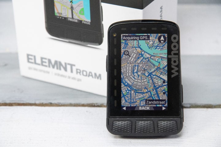
When it comes to rides, like most bike computers you can choose to ride with or without navigation. You’ll always have access to the map either way, but one will also include routing details and turn by turn instructions. The ROAM V2 includes a much larger storage (32GB) which Wahoo basically caches the entire world with. Though oddly, despite that, it still wanted to download the Netherlands map upon setup (roughly about 300MB). Once completed, it did indeed reduce my storage by that much. No big deal, still about 1GB remaining. You can use the Wahoo app to specify which maps you need, and then select them to download via WiFi:
![clip_image001[48]](http://media.dcrainmaker.com/images/2022/10/clip_image00148_thumb.png "clip_image001[48]")
![clip_image001[50]](http://media.dcrainmaker.com/images/2022/10/clip_image00150_thumb.png "clip_image001[50]")
![clip_image001[52]](http://media.dcrainmaker.com/images/2022/10/clip_image00152_thumb.png "clip_image001[52]")
When it comes to routes, you’ve got a few options. If you’ve got accounts on platforms like Strava, Komoot, and others, those routes will automatically sync to the Wahoo ROAM, both the device as well as the companion app. You can also pull in routes from files, create a route from a past historical ride, route back to the start, or put in a specific location to route to. Putting in a specific location does require your phone, it’s not something you can do directly on the unit. Whereas choosing a route from an online platform will sync directly to the device.
![clip_image001[40]](http://media.dcrainmaker.com/images/2022/10/clip_image00140_thumb.png "clip_image001[40]")
![clip_image001[42]](http://media.dcrainmaker.com/images/2022/10/clip_image00142_thumb.png "clip_image001[42]")
![clip_image001[44]](http://media.dcrainmaker.com/images/2022/10/clip_image00144_thumb.png "clip_image001[44]")
![clip_image001[46]](http://media.dcrainmaker.com/images/2022/10/clip_image00146_thumb.png "clip_image001[46]")
For example, if we crack open my unit, and then into the routes option, you see I can retrace a ride, route to the start, take me to (which lets you access saved locations or zoom around on the map), and then my routes down below.
![clip_image001[13]](http://media.dcrainmaker.com/images/2022/10/clip_image00113_thumb.jpg "clip_image001[13]")
![clip_image001[15]](http://media.dcrainmaker.com/images/2022/10/clip_image00115_thumb.jpg "clip_image001[15]")
In my case, I selected a route for today that I synced from Strava. I did find it took about 20-30 seconds for it to actually load the route, which is a bit longer than most (all?) new bike computers released this year. However, as I’d find, it actually took even longer for GPS to acquire.


While it loaded the route, it also looked for GPS. On yesterday’s ride, this took well over 2 minutes to find GPS despite having pretty wide open views of the sky. It did at least tell me that it was still “Poor GPS”. I didn’t notice this previously on rides.

With my route loaded (you can see it above with the chevrons on the map), off we roll. Starting off with the navigation bits, we’ve got a couple different views. Here we can see my route below on the chevrons in the general map view. This view has data fields at the top, including the distance to the next cue (in my case, 420m).

However, you can see as I approach a turn/junction, it pops up an arrow listing what to do next – in this case in 212m away. This will pop-up on any other data pages you have, so if you’re heads down with your power-focused data page, it’ll show up there too.

You can also tap back into the routes page to see a full cue sheet if you want, showing upcoming turns and the distances.

The rest of your data pages are accessible by tapping the ‘Page’ button in the lower right corner. Here you can see my main data page with all my metrics, including the color-coding on my power and heart rate fields:

Here’s an elevation focused data page. Of course, being the greater Amsterdam area, this is as flat as a pancake:

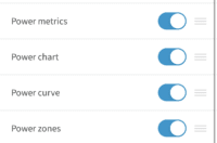
And then here’s a simple custom page I made with just power metrics, and shown at different trailing intervals: 3-seconds, 20-seconds, 30-seconds, and 5-minutes:

Now in my case I’ve got various Strava Live Segments favorited around my area, and I soon come up on one. Here it shows me I’ve got 71 meters remaining until that segment begins, along with the name of it. Then it shortly changes to a gigantic ‘Go’, just in case I wanted to suffer.


Given I have nothing better to do, I give it a whirl. You can change whether you’re targeted your previous PR the KOM by pressing the “VS” button at the bottom. In my case, I’m just targeting myself on this roughly 2KM long venture. However, you can see about halfway through, a trip into another segment. Which also shows. I can tap the ‘SGMNT’ button at the bottom to toggle between the different overlapping segments.


Despite my very lazy attempt at this, I do manage to best my PR. This is mostly because I’m pretty sure I’ve never made much of an effort on this segment (thankfully).

Next, let’s take a look at a structured workout – this time with a a Wahoo SYSTEM workout. These are new this week, specifically, the ability to sync them to your Wahoo device. Practically speaking this is no different than what Wahoo has had for years with their TrainingPeaks and TrainerRoad integration, as well as Today’s Plan.
To set this up for SYSTM, you’ll crack open the system app and then assign a workout to the calendar. Of course, if you’re on a training plan, then it’ll automatically show up. In my case, I added one of the two free ones to my calendar for today:
![clip_image001[54]](http://media.dcrainmaker.com/images/2022/10/clip_image00154_thumb.png "clip_image001[54]")
![clip_image001[56]](http://media.dcrainmaker.com/images/2022/10/clip_image00156_thumb.png "clip_image001[56]")
![clip_image001[58]](http://media.dcrainmaker.com/images/2022/10/clip_image00158_thumb.png "clip_image001[58]")
![clip_image001[60]](http://media.dcrainmaker.com/images/2022/10/clip_image00160_thumb.png "clip_image001[60]")
Once that’s done, you’ll head over to the ROAM and validate it’s synced to the platforms, which it does anytime you turn it on. That should then show up under Planned Workouts. Except, for whatever reason, I couldn’t get it working. So instead, I created a workout using the TrainerRoad app with TrainNow, and sent that to my calendar for today. That worked instantly. So, I added this to my ride, which I’d load later mid-ride:
![clip_image001[17]](http://media.dcrainmaker.com/images/2022/10/clip_image00117_thumb.jpg "clip_image001[17]")
It’ll then iterate through each step of the workout for you:
![clip_image001[19]](http://media.dcrainmaker.com/images/2022/10/clip_image00119_thumb.jpg "clip_image001[19]")
The only downside is that the color-coding of your existing zones overrides the target ranges for the workout. So basically you can see that despite me being out of zone for this target (which was 307-329w), I’m in the green, because that just happens to be my green zone for my power zones. It’s even more pronounced when I’m supposed to be in recovery at 1-155w, yet it shows me at green while I’m doing 300w.
Of course in theory the LED’s along the left side aim to remedy that, but my eyes are very much drawn to the giant green squares rather than the lesser LED’s.
![clip_image001[21]](http://media.dcrainmaker.com/images/2022/10/clip_image00121_thumb.jpg "clip_image001[21]")
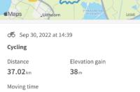
Once we’ve finished with the ride, we’ll get a summary page with an overview of the key stats. We can also toggle into some time-duration views (like the past week/month/etc…) to see our historical stats there:

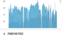
Of course, the majority of stats are actually on the Wahoo ELEMNT companion app, where we can dive into the maps and other data graphs in more detail:

And then as usual, all of this syncs off to 3rd party partners as well. You can set these up earlier on in the Wahoo app, here’s a listing of the current partners:
![clip_image001[34]](http://media.dcrainmaker.com/images/2022/10/clip_image00134_thumb.png "clip_image001[34]")
![clip_image001[36]](http://media.dcrainmaker.com/images/2022/10/clip_image00136_thumb.png "clip_image001[36]")
![clip_image001[38]](http://media.dcrainmaker.com/images/2022/10/clip_image00138_thumb.png "clip_image001[38]")
After a ride it’ll automatically sync to this list, and tends to do so within a minute or two. This showed up in Strava for me no problems, as well as over on Dropbox. This piece works well, and Wahoo also makes it easy to sync again to other partners or manually export files if you need to.
Overall from a ride standpoint, not much has changed with the ELEMNT ROAM V2 compared to other recent Wahoo ELEMNT devices. It all feels about the same. Sure, you do get some new colors, which definitely appear crispier – but, if you’re looking for the same Wahoo experience as the past, you’ll be happy to know it’s the same here. Obviously, I’m waiting on seeing how the upcoming Wahoo Summit Segments appear, as that’d be the biggest feature update to Wahoo bike computers in many many years.
GPS Accuracy:
There’s likely no topic that stirs as much discussion and passion as GPS or heart rate accuracy. A watch could fall apart and give you dire electrical shocks while doing so, but if it shows you on the wrong side of the road? Oh hell no, bring on the fury of the internet!
GPS accuracy can be looked at in a number of different ways, but I prefer to look at it using a number of devices in real-world scenarios across a vast number of activities. I use 2-6 other devices at once, trying to get a clear picture of how a given set of devices handles conditions on a certain day. Conditions include everything from tree/building cover to weather.
In all these tests, the Wahoo ROAM V2 was in a multiband (dual-frequency) GNSS configuration, namely because there is no configuration option otherwise. Thus, it was at the best settings it could have. In most of the tests I was comparing it against another multi-band GPS, the Garmin Edge 1040, which is obviously a bit pricier. Further, on the handlebars I had the similar-priced Hammerhead Karoo 2, and Garmin Edge 830 (neither of which have multiband), while usually having a few watches with me (including the Forerunner 955, which is closer in price and does have multiband).
Let’s get right into it with a farm/buildings/something ride. This ride had a blend of rather difficult stuff, with rather easy stuff. Though, as I’ve long found, sometimes it’s the easy stuff that trips up GPS just as much as the hard stuff. I let it get warmed up out in the farmlands with relatively little tree cover, minus a few bridges.
Starting at a high level, you can see things look pretty solid – virtually identical. Note that in this case, the Fitbit Inspire 3 on my wrist is technically leveraging my phone’s GPS, so, it’s cheating a bit. Whereas later when I show the Fitbit Sense 2, that’s leveraging the internal GPS on the watch. Just wanted to clarify that.

If we start picking random points on the route, most of them are in the farmland. And most of them look scary perfect good between all the units. You’d be hard pressed to convince me at a glance that this is actually four GPS units:

Same goes through this small town, which does actually have some high-rise apartment/retirement home buildings, that I ride directly next to – with zero interference. Same goes for riding under the giant highway.

Here I ride up a short/steep hill, next to the highway and then over an overpass. All sides of this look good – minus the one quirky bit of the Fitbit track doing something weird trying to go play in traffic.

So, let’s get to the spicy part: The City.
This is a downtown test I do, and have been doing for almost all GPS units in the past year or so as multiband units have come on the scene. It typically does a really good job of showing how good multiband can be in a tough environment. Frankly, for all the crazy against 2,000ft rock-wall tests I’ve done in the Alps and other places – it’s this little city section that’s one of the most difficult spots I can find out there. It’s streets barely 2-lanes wide (if that) with 25-35 story buildings on either side.
![clip_image001[23]](http://media.dcrainmaker.com/images/2022/10/clip_image00123_thumb.jpg "clip_image001[23]")
I do three long sweeps up and down three different streets to demonstrate accuracy. Here’s the GPS track from this ride:

As you can pretty easily see, the Wahoo ROAM V2 suffered a fair bit here on the hardest of the three sweeps (the top one). It went all wonky, whereas somewhat surprisingly the Hammerhead Karoo 2 (no multiband GPS) outperformed it. Here’s that section zoomed in a bit. Clearly the best was the Edge 1040 Solar, which was perfectly along that diagonal road.

Now I get it, this is tough stuff. But it’s always kinda why you’re paying for multiband GPS – for the tough stuff.
Next, we’ve got another ride (obviously), this one I started off with that crazy downtown section, and then worked my way out through a variety of overpasses/tunnels towards the airport, followed by a bit of gravel and forests coming back. Here’s the high level overview:

This time as noted we start off in the city in that same section doing the same pattern. This go around the Wahoo ROAM V2 does far better. It beats the Edge 830 (non-multiband). Though, the ROAM V2 is also helped to look better by the completely drunk Fitbit Sense 2, which even makes the Edge 830 look good too. But really, the ROAM V2 and Edge 1040 are very close together here. Each make a singe very minor mistake for 50m or so, but nothing major.

A minute or so later I do a fun two-step tango under a street overpass. The Edge 1040 barely edges out the ROAM for the correct implementation of this, but we’re talking really just a few meters off. The Edge 830 isn’t much off either, but the Fitbit Sense 2 takes the cake for ‘zero effs given’ GPS track.

Next, swinging out to some random bits on the route, we’ve got this 90* turn on some bike paths. The three bike computes absolutely nail this. Perfection. Again, Fitbit decides to go for a swim.

Next, this little section. It’s a great example of multiband. Here we see I take a turn on a bike path street crossing. The Edge 830 (no multiband) is very close, but still about 2 meters off. Whereas the Wahoo ROAM V2/Edge 1040 Solar hit it spot on. Also, note the second arrow. That’s where I stopped for a minute or two to take some photos of the units. You can even see the little indent where I moved my bike just one meter to the side of the road to take those photos on a fence post.

Next, here’s an intersection under a slate of highway overpasses and roads. All the units nail the big highway (to the right), but it’s actually the Edge 830 that correctly gets the highway overpass/tunnel to the left correctly. Fitbit just gave up on life.

Finally, this section in the trees. I’ll just pick one section here, since they’re all pretty similar. Here I missed the turn and had to backtrack. You can see the ROAM V2/Edge 1040 Solar handle it very much the same, whereas there’s a bit of wobble from the Edge 830 off into the trees.

Ok, with that ride behind us, let’s do some repetition fun. In this ride I’m going to head across town to an outside cycling track that’s about 2KM in length. And I’m going to do it over and over and over again. I want to see how precise the GPS tracks are from the ROAM on repeated loops (left hand corner).

And I want to in particular look at a few sections to compare. And to be clear upfront, the ROAM did a good job here. Things are generally very close or on the route the entire time. But, the name of the game here is repeated perfection with a multiband config. Here’s one of the corners, where you can see the ROAM is generally on the corner, and usually on the road – though, a few times off in the grass.

For comparison, here’s the Edge 1040 in its multiband config. You’ll notice every single line is on the roadway, usually right on the edge where I took the corner (a few times I took it a bit wider because of other cyclists/etc…). It’s a minor example, but something we’ve seen from Garmin in other multiband devices, just barely edging out the competition (including edging out Apple & COROS’s multiband implementations). In most cases though, it frankly won’t matter.

Here’s another example at another corner up top. This one it seems to handle better. Note that you shouldn’t look at the ‘grey’ section on the map, as that’s actually a transparent overlay from Google. The real road is under the edge of the trees in this satellite view, and thus the cutting under the trees is indeed correct.

I don’t see any meaningful difference between these two on this section – they seem roughly identical.

Still, things are very good. But since this section is all about nuanced details, I figured I’d show it.
In any case, overall I’m seeing good things with Wahoo’s implementation. While I’ve had a few minor quirks, on the whole it’s doing better than the Edge 830 is in most cases in some trickier forest spots, though a wash in most other spots. It’ll be interesting to see how Wahoo can tweak/tune it over the coming year to really get the most out of it. In most multiband implantations we’ve seen, some months later we continue to see improvements through firmware updates.
Finally, a quick word about gradient accuracy. Unfortunately, in the time I’ve had the Wahoo ROAM V2 I haven’t had access to any meaningful hills (I live in Amsterdam, the biggest hill I have is a highway overpass). And while I did said overpass a few times, it’s just so short that getting much data from it isn’t super useful. In the handful of highway overpasses (both steep and more smoothed) I did, it reacted basically the same as the Wahoo BOLT V2 does – which is to say it’s mostly slower than the Hammerhead Karoo 2, but usually faster than the Garmin Edge 1040. Not always, sometimes it’s a wash, sometimes not. For example, today during these loops there a very short but steep hill (10-seconds or so at 8%-ish) in the middle of it. None of the three units on my handlebars even registered it till afterwards (Wahoo ROAM V2, Garmin Edge 830, Edge 1040). Once Wahoo releases their Summit Segments bit, I’ll go figure out a place to get a hill(s) and sort things out there.
(Note: All of the charts in these accuracy portions were created using the DCR Analyzer tool. It allows you to compare power meters/trainers, heart rate, cadence, speed/pace, running power, GPS tracks and plenty more. You can use it as well for your own gadget comparisons, more details here.)
Wrap-Up:
![clip_image001[25]](http://media.dcrainmaker.com/images/2022/10/clip_image00125_thumb.jpg "clip_image001[25]")
The ROAM V2 is a needed but modest hardware upgrade for Wahoo, especially in the realm of adding in multiband GPS – making it the least expensive multiband GPS bike computer on the market (there are other cheaper watches, but not yet other bike computers that are less expenses). The larger space for maps is super handy, both in terms of just having more maps onboard for when you travel – as well as the added details that Wahoo says they were able to fit in with that space.
In terms of usability and simplicity, that all remains the same. The ROAM V2 doesn’t change that in any way, and it’s just as easy to use as the previous ROAM (and other Wahoo bike computers) have been. As is Wahoo’s app, which eschews complexity and deep menus in favor of a strong KISS end-goal. And out on the road, all of that works well too, without too much fuss. Again, simplicity is the name of the game here – even if the interface is still a bit slow compared to most other units out there.
The challenge Wahoo has though, is twofold. First, the marquee software features they announced for the ROAM V2 simply aren’t here yet. And even once released, they are at best keeping up with bike computers from years ago. We’ve seen Hammerhead this past spring demonstrate route-less CLIMBER, which doesn’t require any route be loaded at all. Whereas Wahoo is only going to introduce route-required Summit Segments (like Garmin). Which gets to the second issue, that all of this ignores the piles of new features and capabilities that both Hammerhead and Garmin have added in recent years (or even recent weeks/months). It’s non-stop, and with a public beta program to flush out issues before they hit most users.
I suspect you’ll see most reviewers today try and skirt this elephant in the room. Sure, it’s the best Wahoo ELEMNT to date, but only just barely. And I’m not sure “barely” is good enough anymore. Wahoo used to be pushing the boundaries of bike computers and features, but these days that mojo is simply gone. Hammerhead apparently stole it. I don’t know if the issue is trying to tackle too many product lines with not enough resources, or just the realities of becoming a bigger company.
If you’ve got an older Wahoo ELEMNT or older BOLT and were looking for an upgrade within the Wahoo ecosystem, then this is probably the one for you. And if you just want a super easy to use bike computer with basic navigation, and don’t care about other features, this works too. But beyond that, I think it’s gonna put Wahoo in a tough spot next spring when we’ll undoubtedly see hardware refreshes from most of their competitors in this price ballpark that already have deeper offerings. I just wish Wahoo find find their mojo again.
With that – thanks for reading!